GPSArtify
Asia–Pacific

Strava art in Singapore

3 Strava art routes for Singapore, from an 11.5 km heart by the river to a 47.0 km bird that reaches Toa Payoh, with a 37.9 km runner in between.

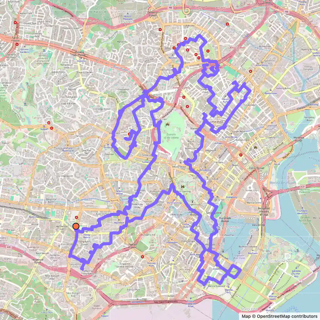
Strava art route: a running figure drawn across central Singapore, starting near Tiong Bahru Park
Runner, 37.9 km, Singapore.

Strava art routes in Singapore

  • Runner, 37.9 km, Singapore. Its map is at the top of the page. Map © OpenStreetMap contributors

    Runner, 37.9 km

    Length
    37.9 km
    Mode
    Urban
    Starts near
    Tiong Bahru Park
    Main streets
    Havelock Road → Race Course Road → Serangoon Road → Scotts Road → Orchard Promenade

    The runner starts by Tiong Bahru Park; from top to bottom the figure measures about 5.4 km.

    It crosses the Singapore River at least three times, among them on Elgin Bridge and Cavenagh Bridge, and follows Marina Way and Stamford Road; its longest stretches are Scotts Road (about 1.2 km), Race Course Road, Havelock Road and Serangoon Road.

    The generator's minimum for the runner is 35 km; this one measures 37.9 km.
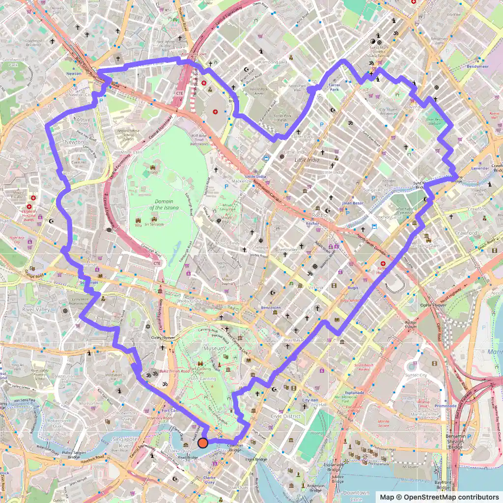
  • Strava art route: a heart drawn in central Singapore, starting near Ord Bridge on the Singapore River
    Heart, 11.5 km, Singapore. Map © OpenStreetMap contributors

    Heart, 11.5 km

    Length
    11.5 km
    Mode
    Urban
    Starts near
    Ord Bridge
    Main streets
    River Valley Road → Cairnhill Road → Keng Lee Road → Race Course Road → North Bridge Road

    Starting near Ord Bridge on the Singapore River, this 11.5 km heart spans roughly 2.8 km.

    Its outline uses River Valley Road, Cairnhill Road, Keng Lee Road, Race Course Road and North Bridge Road, the last for about 950 m. Race Course Road is on the runner's route too.

  • Strava art route: a large bird drawn across Singapore, starting near Telok Ayer Park
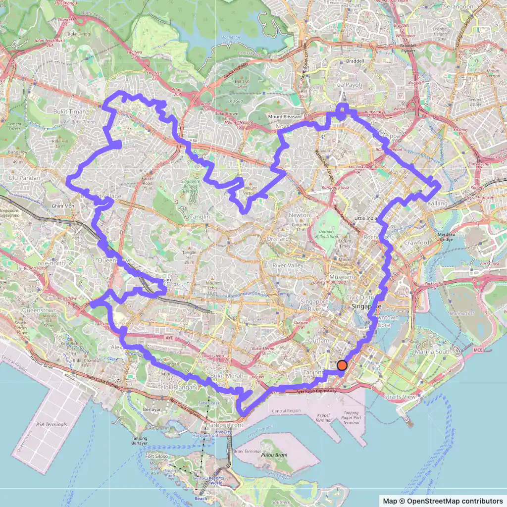
    Bird, 47.0 km, Singapore. Map © OpenStreetMap contributors

    Bird, 47.0 km

    Length
    47.0 km
    Mode
    Urban
    Starts near
    Telok Ayer Park
    Main streets
    Rail Corridor → Telok Blangah Heights → Coronation Road West → Dalvey Road → Whampoa Park Connector

    The bird leaves from Telok Ayer Park and is the largest of the three at 47.0 km; east to west it spans some 8.5 km.

    It follows the Rail Corridor, passes Mount Faber Loop and Telok Blangah Heights, and its longest street is Coronation Road West, about 1.6 km.

    Later it takes Dalvey Road, reaches Lorong 2 Toa Payoh and comes back along the Whampoa Park Connector.

Generated with GPSArtify on 6 November 2026.

Singapore as a Strava art canvas

The Singapore River runs about 3.2 km to Marina Bay, past three quays: Robertson Quay, the largest and furthest upstream, then Clarke Quay and Boat Quay. Since the Marina Barrage was completed in 2008 it has been a freshwater river.

Our runner crosses the river several times, on Elgin Bridge and Cavenagh Bridge among others, and the heart starts near Ord Bridge, further upstream.

Park connectors and paths count as routes too: the bird follows the Rail Corridor, the Alexandra-Queensway Park Connector and the Whampoa Park Connector.

Only the heart, at 11.5 km, suits an everyday run. The runner (37.9 km) and the bird (47.0 km, some 8.5 km wide) are rides or very long runs.

Plan your Strava art in Singapore

  1. Open our Strava art generator, the GPS art generator that planned this GPS art, and move the map to Singapore.
  2. Pick a shape and a distance; the route is fitted to real streets.
  3. Export the GPX to Strava, Garmin, Wahoo or Komoot, then run or ride it.