GPSArtify
Asia–Pacific

Strava art in Melbourne

In Melbourne we planned 4 Strava art routes: a 12.0 km balloon through Fitzroy and Carlton, an acorn through the city centre, and two long rides, a bird along the Yarra and a star from St Kilda.

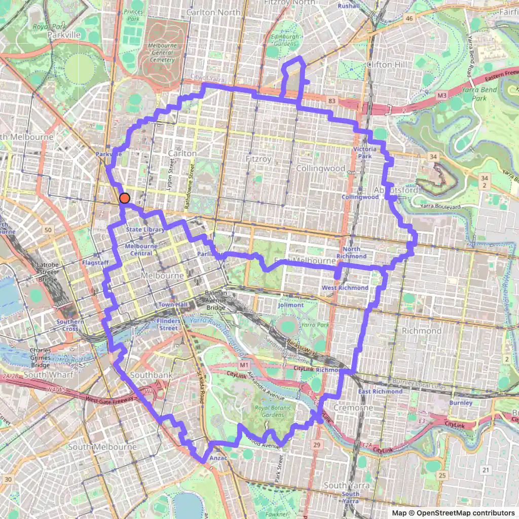
Strava art route: an acorn drawn across Melbourne's centre and inner suburbs, starting near Lincoln Square
Acorn, 25.1 km, Melbourne.

Strava art routes in Melbourne

  • Acorn, 25.1 km, Melbourne. Its map is at the top of the page. Map © OpenStreetMap contributors

    Acorn, 25.1 km

    Length
    25.1 km
    Mode
    Urban
    Starts near
    Lincoln Square
    Main streets
    Gipps Street → Lennox Street → Elizabeth Street → Cecil Street → Kings Way

    The acorn runs right through the city centre: its streets include Lonsdale Street and Queen Street, both inside the Hoddle Grid.

    From there it reaches east on Gipps Street and Lennox Street and south over the Yarra to Kings Way and Domain Road.

    25.1 km, about 4 km wide and 5 km tall, starting near Lincoln Square.
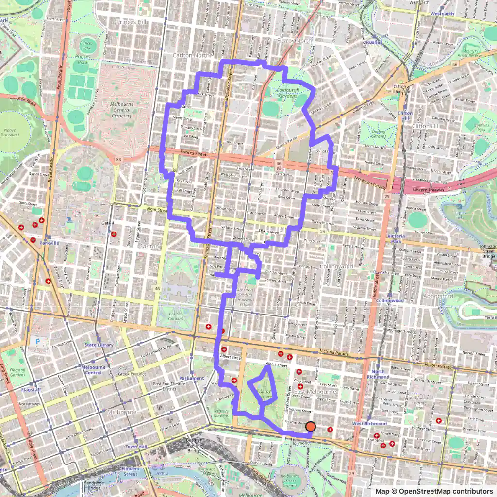
  • Strava art route: a balloon drawn through Fitzroy and Carlton, Melbourne, starting near Queen's Walk
    Balloon, 12.0 km, Melbourne. Map © OpenStreetMap contributors

    Balloon, 12.0 km

    Length
    12.0 km
    Mode
    Urban
    Starts near
    Queen's Walk
    Main streets
    Fitzroy Street → Smith Street → Rathdowne Street → Drummond Street → Bell Street

    A tall, narrow balloon, 1.6 km wide and 3.5 km from top to bottom, which suits the long north–south streets it follows: Fitzroy Street, Smith Street, Rathdowne Street and Drummond Street.

    At 12.0 km it is the run of the four.

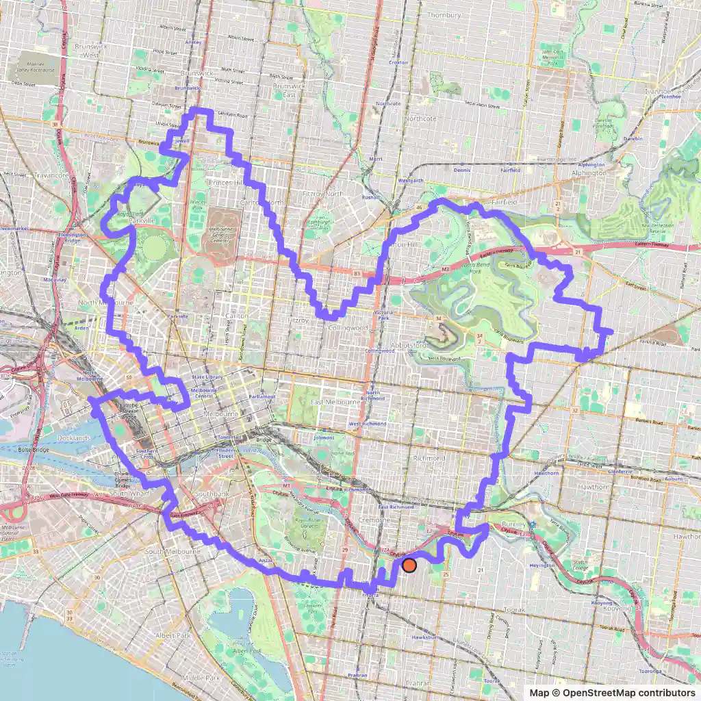
  • Strava art route: a bird drawn across inner Melbourne along the Yarra, starting near Durham Street Reserve
    Bird, 43.9 km, Melbourne. Map © OpenStreetMap contributors

    Bird, 43.9 km

    Length
    43.9 km
    Mode
    Urban
    Starts near
    Durham Street Reserve
    Main streets
    Park Street → Main Yarra Trail → Yarra Boulevard → Main Drive → Stawell Street

    This bird leans on the river: a long stretch follows the Main Yarra Trail and Yarra Boulevard, and it crosses on the Fairfield Pipe Bridge among others.

    It also uses the Capital City Trail, South Wharf Promenade and Hoddle Street, and measures about 8 km each way; at 43.9 km it is a ride.

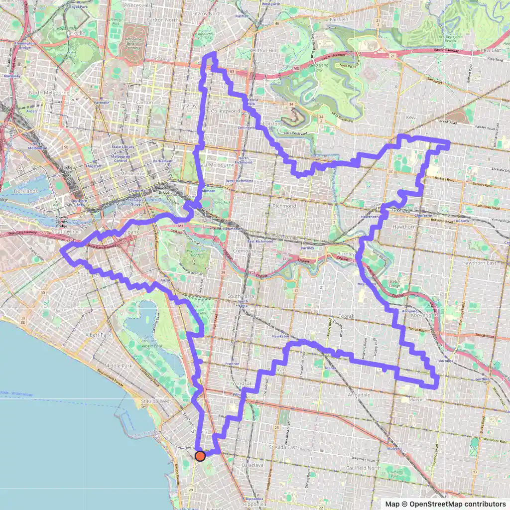
  • Strava art route: a star drawn from St Kilda across inner Melbourne, starting near Acland Street Plaza
    Star, 44.2 km, Melbourne. Map © OpenStreetMap contributors

    Star, 44.2 km

    Length
    44.2 km
    Mode
    Urban
    Starts near
    Acland Street Plaza
    Main streets
    St Kilda Road → Normanby Road → Gore Street → Glenferrie Road → Malvern Road

    The star starts by the bay, near Acland Street Plaza in St Kilda, and heads north on St Kilda Road.

    Its points reach Gore Street in the north and Glenferrie Road in the east before Malvern Road and Chapel Street bring it back; 44.2 km in all.

Generated with GPSArtify on 3 November 2026.

Melbourne as a Strava art canvas

Melbourne's centre is the Hoddle Grid, a grid of streets about 1.6 km by 0.8 km marked out in 1837 and bounded by Flinders, Spring, La Trobe and Spencer Streets. It sits at an angle to the rest of the city's street grid. The city also lines much of the northern and eastern shore of Port Phillip Bay.

Long straight streets make tall shapes easy: our balloon is more than twice as tall as it is wide, and its longest streets are Fitzroy, Smith, Rathdowne and Drummond Streets. The acorn passes through the Hoddle Grid itself on Lonsdale and Queen Streets.

The Yarra winds through our routes too. The bird uses the Main Yarra Trail and Yarra Boulevard along it, and the star starts at the bay in St Kilda.

Plan your Strava art in Melbourne

  1. Open our Strava art generator, the GPS art generator that planned this GPS art, and move the map to Melbourne.
  2. Pick a shape and a distance; the route is fitted to real streets.
  3. Export the GPX to Strava, Garmin, Wahoo or Komoot, then run or ride it.