GPSArtify
Europe

Strava art in Budapest

GPSArtify is made in Budapest, and our Strava art generator opens on Budapest when it cannot tell where you are. Below are 4 routes we planned on the city's streets with the same generator you can use, each with its real length, where it starts and the main streets it follows.

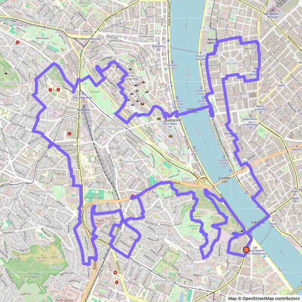
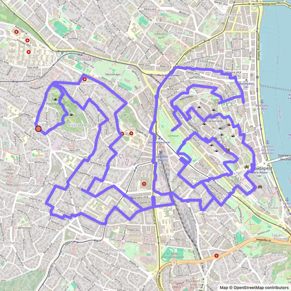
Strava art route: the number 26 drawn on the streets of Buda, Budapest, starting near Szent Orbán tér
26, 23.8 km, Budapest.

Strava art routes in Budapest

  • 26, 23.8 km, Budapest. Its map is at the top of the page. Map © OpenStreetMap contributors

    26, 23.8 km

    Length
    23.8 km
    Mode
    Urban
    Starts near
    Szent Orbán tér
    Main streets
    Gaál József út → Határőr út → Kiss János altábornagy utca → Alkotás utca → Krisztina körút

    The number 26 stays on the Buda side from start to finish and never crosses the Danube.

    It starts near Szent Orbán tér, and its longest single street is Kiss János altábornagy utca, followed for about 1.2 km.

    At 23.8 km it is a long run or a short ride.
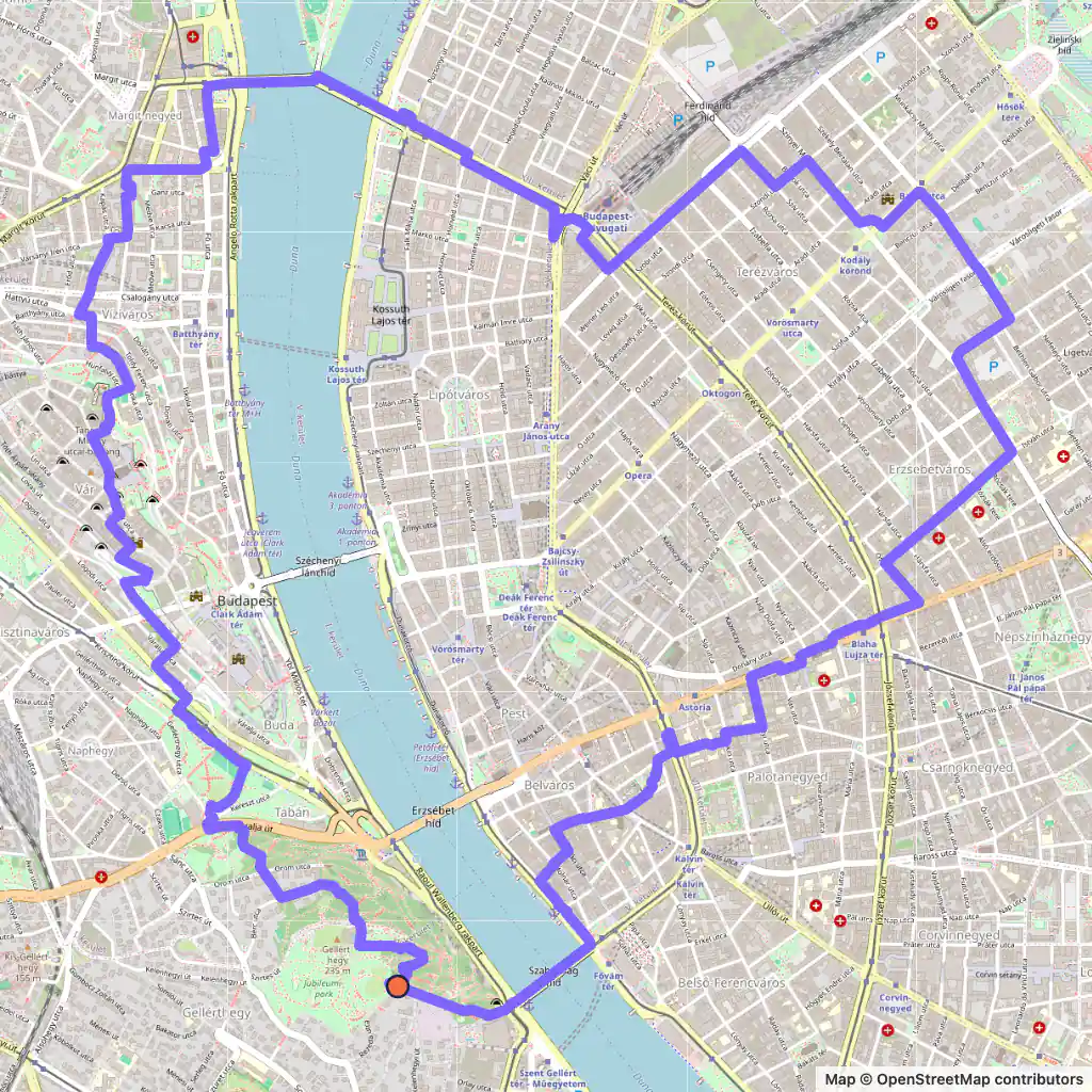
  • Strava art route: a heart drawn across both banks of the Danube in Budapest, starting near Citadella park
    Heart, 14.2 km, Budapest. Map © OpenStreetMap contributors

    Heart, 14.2 km

    Length
    14.2 km
    Mode
    Urban
    Starts near
    Citadella park
    Main streets
    Margit híd → Szent István körút → Podmaniczky utca → Bajza utca → Dohány utca

    This heart starts on Gellért Hill by Citadella park and crosses the river twice: first on Margit híd (Margaret Bridge), then back on Szabadság híd (Liberty Bridge).

    In Pest it follows Szent István körút, Podmaniczky utca and Bajza utca before Dohány utca leads it back towards the river.

    At 14.2 km it is the shortest of the four.

  • Strava art route: a cat drawn mostly across Buda, Budapest, starting near Szent Gellért tér
    Cat, 23.1 km, Budapest. Map © OpenStreetMap contributors

    Cat, 23.1 km

    Length
    23.1 km
    Mode
    Urban
    Starts near
    Szent Gellért tér
    Main streets
    Szent Gellért rakpart → Hegyalja út → Schweidel utca → Széchenyi lánchíd → Akadémia utca

    The cat begins at Szent Gellért tér, at the Buda end of Liberty Bridge, and draws its body through Buda along the Szent Gellért rakpart embankment, Hegyalja út and Schweidel utca.

    One line reaches Pest over Széchenyi lánchíd, the Chain Bridge, and runs along Akadémia utca and past Kossuth Lajos tér before the route returns over Liberty Bridge.

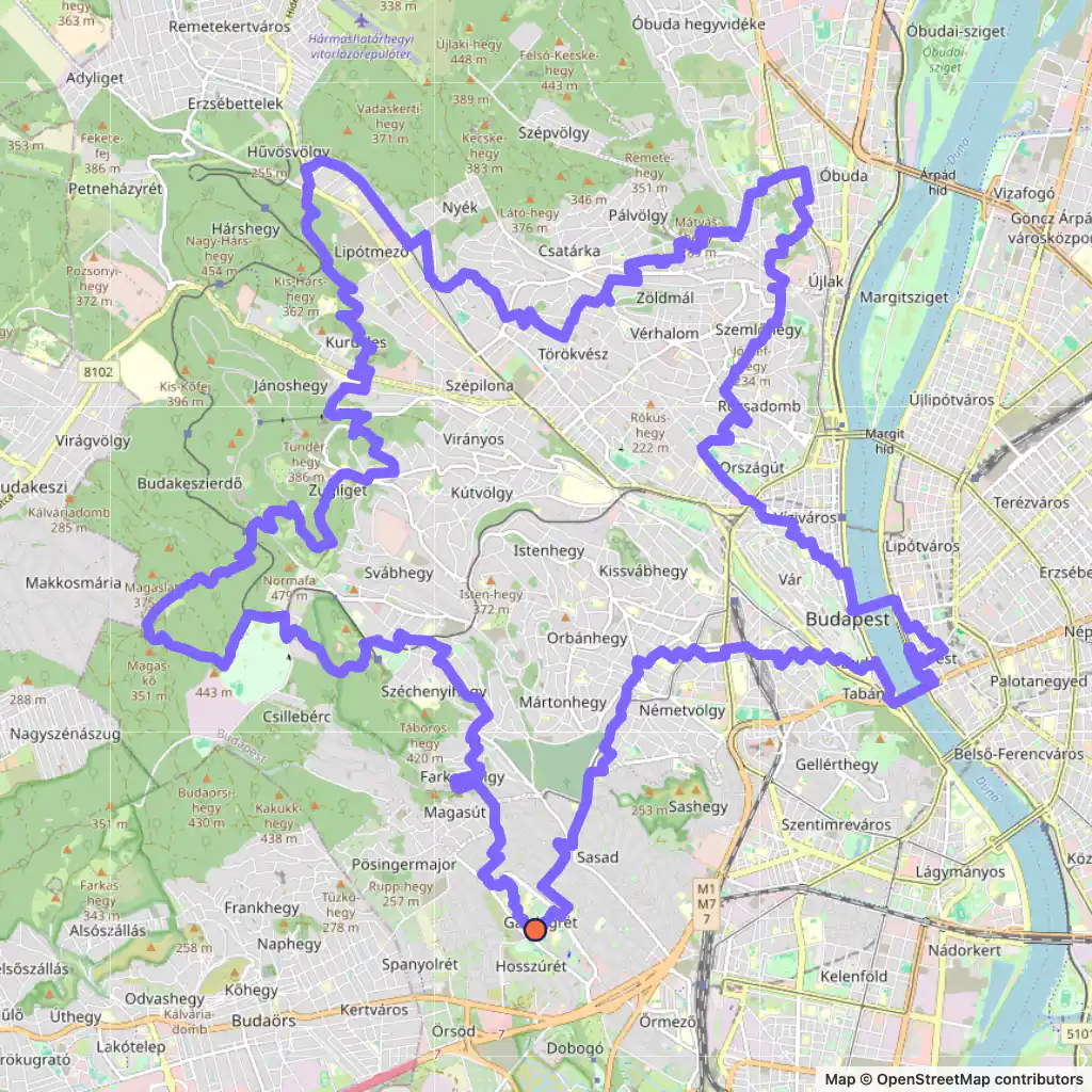
  • GPS art route: a large star drawn across the hills of Buda, Budapest, starting near Dzsungel park
    Star, 46.8 km, Budapest. Map © OpenStreetMap contributors

    Star, 46.8 km

    Length
    46.8 km
    Mode
    Urban
    Starts near
    Dzsungel park
    Main streets
    Edvi Illés út → Mátyás király út → Völgy utca → Bimbó út → Németvölgyi út

    The star is the big one: 46.8 km and about 8 km from its western point to its eastern point, so it suits a bike.

    Its points reach into the hilly part of Buda on Mátyás király út, Völgy utca and Bimbó út, and one arm dips to the river, crossing on the Chain Bridge and Erzsébet híd (Elisabeth Bridge).

Generated with GPSArtify on 3 November 2026.

Budapest as a Strava art canvas

The Danube flows through Budapest from north to south. Buda, on the west bank, is hilly; Pest, on the east bank, lies on the flat ground of the Great Plain. Inside the city the river also wraps around two islands, Óbuda Island and Margaret Island.

A route can only cross the river on a bridge, so a shape that spans both banks needs a bridge wherever one of its lines meets the Danube. Three of our four routes do: the heart uses Margaret Bridge and Liberty Bridge, the cat the Chain Bridge and Liberty Bridge, the star the Chain Bridge and Elisabeth Bridge. The 26 avoids the question by staying in Buda.

We asked the generator for 12, 21, 26 and 40 km. Fitted to real streets, the routes came out at 14.2, 23.1, 23.8 and 46.8 km, so leave yourself some slack when you pick a distance here.

Where there are no streets, Freestyle mode draws on open ground instead: the two hearts further down were drawn freehand in a park on Óbuda Island.

Drawn by the GPSArtify team in Budapest

The GPSArtify team drew these two hearts in Budapest, and they are also on our Strava art ideas page.

  • Two hearts drawn freehand in a park on Óbuda Island, Budapest
    Two hearts, Budapest

Strava art ideas by shape

Plan your Strava art in Budapest

  1. Open our Strava art generator, the GPS art generator that planned this GPS art, and move the map to Budapest.
  2. Pick a shape and a distance; the route is fitted to real streets.
  3. Export the GPX to Strava, Garmin, Wahoo or Komoot, then run or ride it.