GPSArtify
North America

Strava art in Montreal

Seven of the GPSArtify team's own Strava art routes on this site were drawn in Montreal. These 4 routes are new: a flower, a squirrel and a snowflake on and around Mount Royal, and a maple leaf north of it.

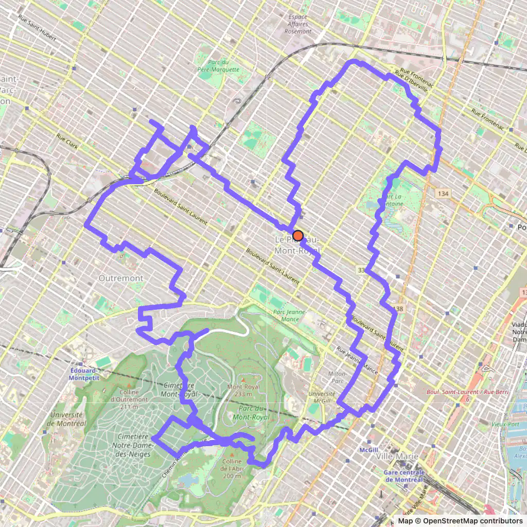
Strava art route: a squirrel drawn from Mount Royal across the Plateau, Montreal, starting near Parc Denise Morelle
Squirrel, 29.3 km, Montreal.

Strava art routes in Montreal

  • Squirrel, 29.3 km, Montreal. Its map is at the top of the page. Map © OpenStreetMap contributors

    Squirrel, 29.3 km

    Length
    29.3 km
    Mode
    Urban
    Starts near
    Parc Denise Morelle
    Main streets
    Rue Drolet → Avenue Van Horne → Boulevard Rosemont → Rue Saint-Denis → Boulevard Saint-Joseph Est

    A squirrel for a mountain that has real ones: the route climbs onto Mount Royal on Redpath Crescent and Chemin Olmsted, then heads north to Avenue Van Horne and Boulevard Rosemont.

    It starts near Parc Denise Morelle on Rue Drolet and later follows Rue Saint-Denis and Boulevard Saint-Joseph Est; 29.3 km.
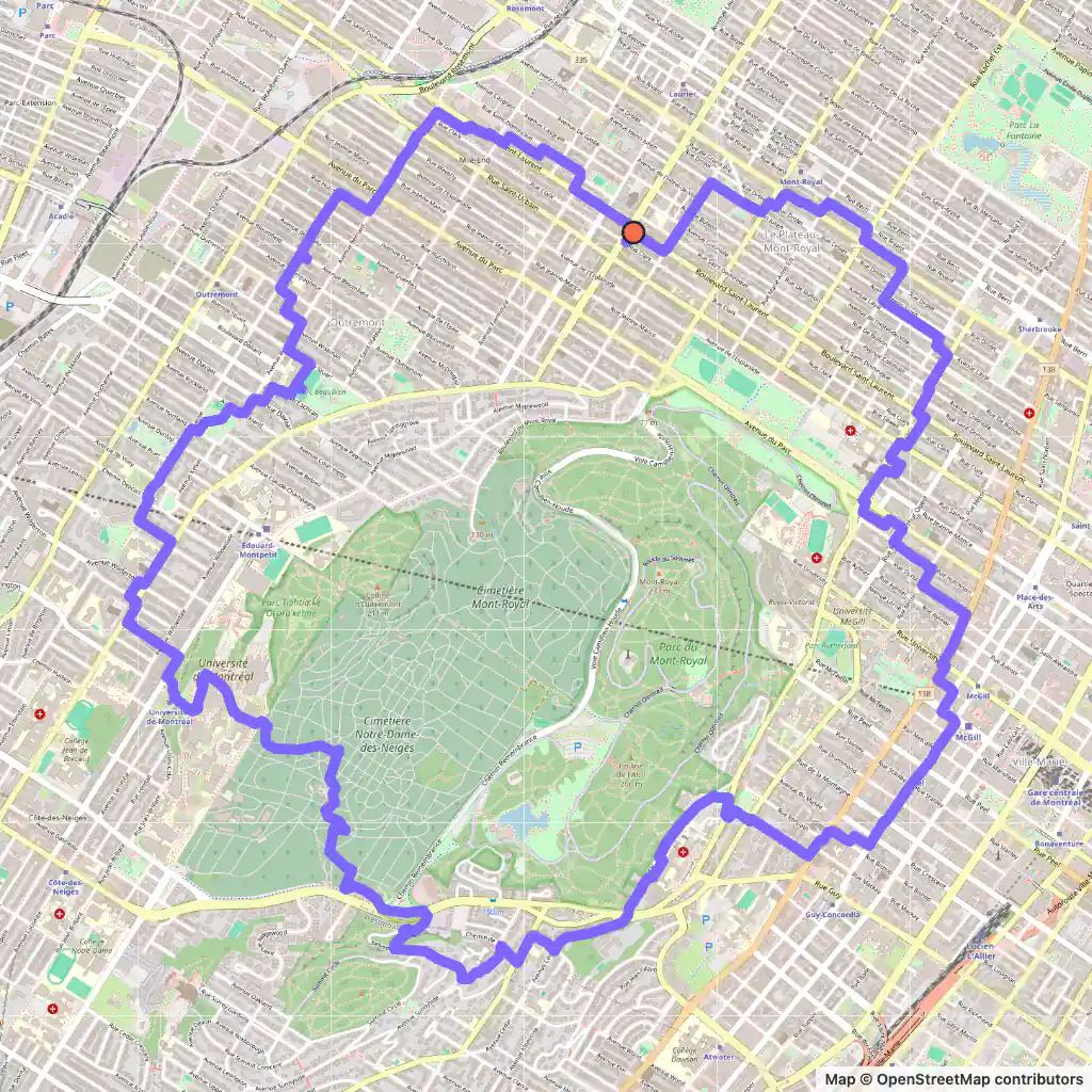
  • GPS art route: a flower drawn around Mount Royal, Montreal, starting near Parc Lahaie
    Flower, 16.9 km, Montreal. Map © OpenStreetMap contributors

    Flower, 16.9 km

    Length
    16.9 km
    Mode
    Urban
    Starts near
    Parc Lahaie
    Main streets
    Boulevard Saint-Laurent → Boulevard De Maisonneuve Ouest → Avenue Cedar → Belvedere Road → Avenue Lajoie

    The flower starts near Parc Lahaie on Boulevard Saint-Laurent and wraps its petals around the mountain on Avenue des Pins Ouest, Avenue Cedar, Belvedere Road, Chemin de la Côte-Sainte-Catherine and Avenue Lajoie.

    At 16.9 km it is the shortest of the four.

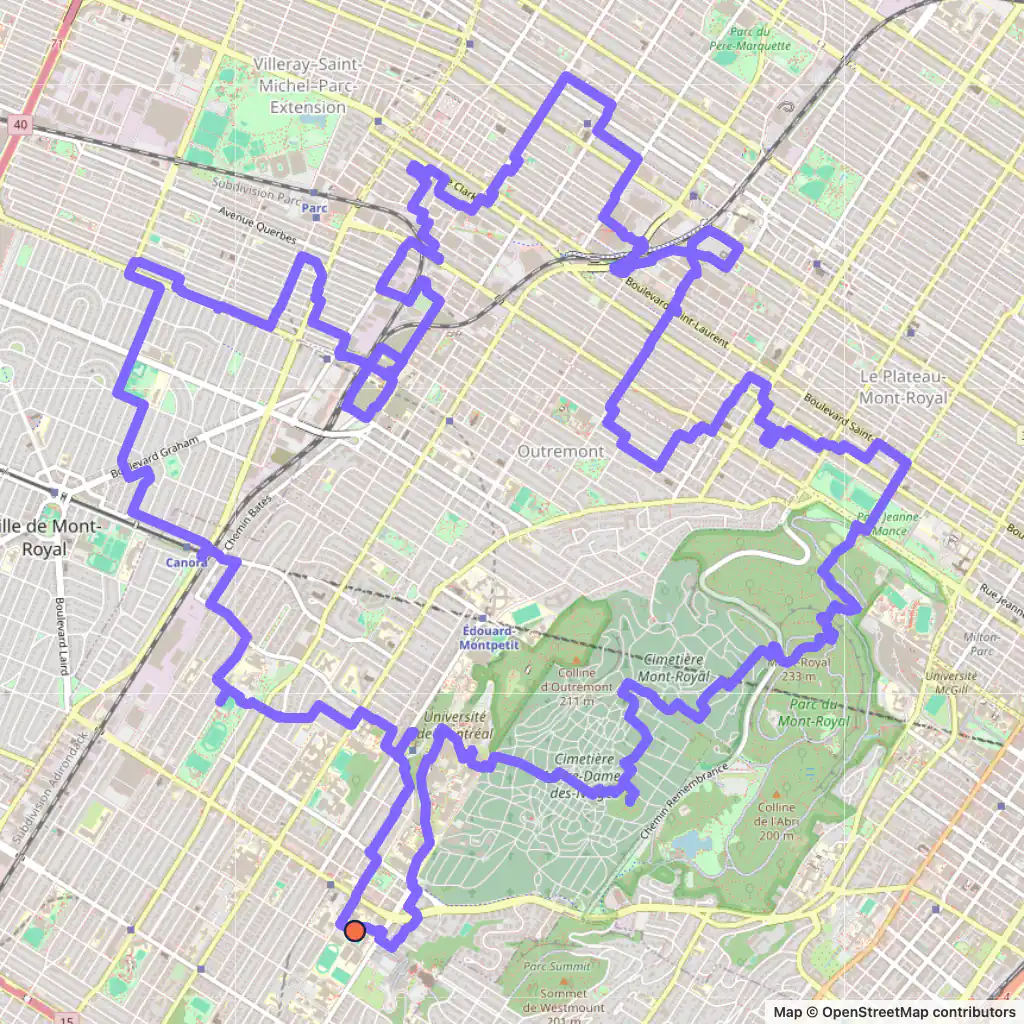
  • GPS art route: a maple leaf drawn north of Mount Royal, Montreal, starting near Côte-des-Neiges station
    Maple leaf, 29.2 km, Montreal. Map © OpenStreetMap contributors

    Maple leaf, 29.2 km

    Length
    29.2 km
    Mode
    Urban
    Starts near
    Côte-des-Neiges
    Main streets
    Avenue Vivian → Avenue Thérèse-Lavoie-Roux → Rue Saint-Urbain → Rue Saint-Zotique Est → Chemin de la Tour

    The maple leaf starts near Côte-des-Neiges metro station and spreads north of the mountain; its streets run from Avenue Vivian to Rue Saint-Hubert.

    It follows 26 different named streets for at least 300 m each, so the leaf's points come from a lot of turns; it is 29.2 km and about 4.4 by 4.9 km.

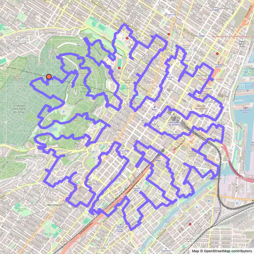
  • GPS art route: a dense snowflake drawn over downtown Montreal and Mount Royal, starting on Chemin Remembrance
    Snowflake, 50.6 km, Montreal. Map © OpenStreetMap contributors

    Snowflake, 50.6 km

    Length
    50.6 km
    Mode
    Urban
    Starts near
    Chemin Remembrance
    Main streets
    Chemin Olmsted → Avenue des Pins Ouest → Rue Sherbrooke Ouest → Rue Sainte-Catherine Ouest → Rue Peel

    The most compact route here for its length: 50.6 km packed into about 3.7 by 3.9 km, because a snowflake is made of many short arms.

    It starts on Chemin Remembrance on the mountain and reaches downtown on Rue Sherbrooke Ouest, Rue Sainte-Catherine Ouest and Rue Peel, down to Rue Saint-Paul Ouest.

Generated with GPSArtify on 3 November 2026.

Montreal as a Strava art canvas

Montreal covers most of the Island of Montreal, between the Saint Lawrence River to the south and the Rivière des Prairies to the north. In its middle stands Mount Royal, a three-peaked hill 232 m high just west of downtown; two roads cross it, Camillien Houde Way (Remembrance Road on part of its route) and Côte-des-Neiges Road.

The mountain is the feature our routes keep coming back to. The flower wraps around it on Avenue des Pins Ouest, Avenue Cedar and Belvedere Road, the snowflake starts on Remembrance Road, and the squirrel climbs it on Chemin Olmsted, while the maple leaf spreads out north of it.

Drawn by the GPSArtify team in Montreal

The GPSArtify team planned these seven routes in Montreal; each is also on our Strava art ideas page with a tip on how to draw it.

  • Easy Strava art: an ice cream cone drawn across Montreal
    An ice cream across Montreal, planned with GPSArtify.
  • Strava art example: a cartoon dog drawn across Montreal
    Cartoon dog, Montreal
  • Easy Strava art: the pi symbol drawn across Montreal
    Pi, Montreal
  • Strava art example: an Easter bunny drawn across Montreal
    Easter bunny, Montreal
  • A shamrock drawn across the streets of Montreal
    Shamrock, Montreal
  • A bicycle drawn across the streets of Montreal
    Bicycle, Montreal
  • Strava art example: a figure drawn across Montreal
    Figure, Montreal

Strava art ideas by shape

Plan your Strava art in Montreal

  1. Open our Strava art generator, the GPS art generator that planned this GPS art, and move the map to Montreal.
  2. Pick a shape and a distance; the route is fitted to real streets.
  3. Export the GPX to Strava, Garmin, Wahoo or Komoot, then run or ride it.